That is quite a claim to make that one cycle ride could be the best in a county, but I think I am justified. It is a circular route from our house in Garstang (which is nearly at sea level), and is basically from Garstang , over the Trough of Bowland (950ft), through or near Whitewell, on to Chipping and then back to Garstang via Inglewhite. Depending which alternatives you choose it is 36 to 40 miles and well over 2000ft of climbing. Today I chose the anti-clockwise route, including an extra hill, so I cycled 36 miles, climbed over 2,600ft and did it in 4 hours and 3 minutes. The weather improved whole way round and yesterday’s rain meant clear views.

And so I left home at bang on 2 and set off on back roads through Inglewhite going past their cross on the green and on to the village of Chipping where I had some sweet coffee just outside the church. Shortly before Chipping I had this lovely view of Parlick (1400ft) with more of the Bowland Fells behind. My daughter and son-in-law were up there yesterday and came back as drowned rats.

Having been fortified with unhealthy sugar and witnessing a retired cleric bombing down a hill on a mobility scooter I set off and turned left on a lane where I was presented with a fine view of Pendle Hill of witches’ fame and for giving the type section of the Bowland Shales. The top of the hill is – Pendle Grit!

And so onwards and upwards needing to climb over 300ft on this stretch. I was now on Her majesty’s lands – i.e the Duchy of Lancaster. The hills were unklike the Pendle Grit Fells just to the easy as they were knolls of limestone – in fact limestone mud, but I didn’t stop to look for fossils.
 And so upwards past a farm. Somewhere I saw a stoat or a weasel. I was quite pleased to get to the top with my ticker ticking at about 142 beats per minute. A quick stop for the view and then whoosh – downhill – but kept stopping for photos.

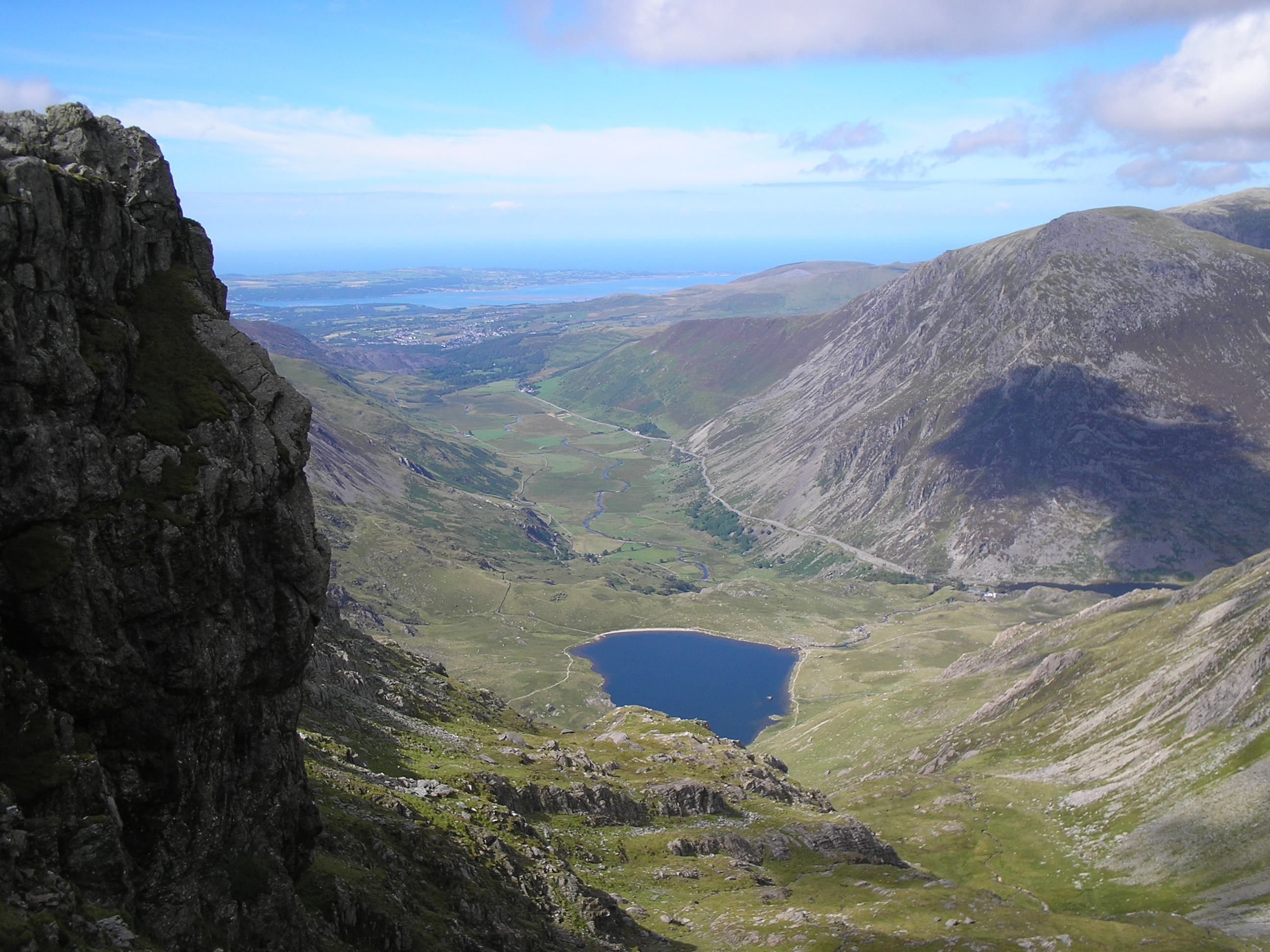
And so looking down to the River Hodder 300 ft below and the upper Hooder beyond Dunsop Bridge behind with a Yorkshire Dales mountain just visible. As you see the country scents were not honeysuckle, but common and garden shit.

Another fine view with Waddington Fell to the right. There’s another grand ride over there.
 It was tempting to shout “chocks away” here and I did, but only touched 30 mph before caution prevailed with bends ahead. Straight ahead in the valley is Dunsop Bridge – the official centre of mainland Britain. It is famous for its ducks and a café.

Well, down to a bridge of the Hodder, one of the cleanest rivers in Lancs. Off to the left is Whitwell with its posh pub and scenic church, which has a wedding every five minutes. The Environment Agency planted all these trees to protect the bank. Last year I met the man who planted them and doted on them. A good example of an EA employee.
And so I pedalled up the Hodder Valley but  turned left instead of going to Dunsop Bridge up my favourite Bowland river – Langdon Brook, which has two incredible upper tributaries. Another steady climb past a Catholic church celebrating its 150th birthday and then looking down on Langdon Brook. I love this stretch of road. I looked over to a 20,000 year old landslide, where an area of 100 by 300 yards of Bowland Shales decided to slide downhill and may have dammed the river. Ancient landslips are very common here.
 And so I stopped by a little bridge just up from the usual carpark. I first chatted to a horse and then consumed the rest of my unhealthy coffee. The view uphill was to Sykes farm, a delightful place right on the road . The hill behind is Top of Blaze Moss, which I have been over many times following invisible paths.
 The view the other way showed where I had come from and gives no idea what lay ahead.

After Sykes Farm I went past Sykes Anticline, a great geological site of limestone. Last year I collect a large hunk of coral which I pooped into my panniers, From here it was all uphill with over 400ft of climbing in a mile.

I stopped for an undisclosed reason and took a photo of my steed with the Sykes Anticline behind. 200 years ago lead was mined half way up the crag.

This photo looking uphill is deceptive. You can just make out a car on the steep part of the climb (directly above the 3rd post from the left) As I remounted I engaged my baby chainwheel ready for the grind up. I got up with a gear to spare (but I do have reduction gearing) and cycled past a fine exposure of the Upper Bowland Shales, but did not stop to look at them. My ticker got to 152 ticks a minute up this hill!!
 And so to the summit, with a lovely view behind. I soon passed the Yorks/Lancs boundary stone and then it was downhill all the way with a thousand feet of altitude to lose.
 Now this was the reward, a fantastic descent through moorland to the upper Wyre valley. It is the right gradient as you go fast but not to fast.
 Leaving the moorland behind , The Marshaw valley is exquisite, especially as no one was there. A lovely river with trees either side – and – of course – FOXGLOVES.
 But just off the road you can go through a gate onto the moors again but bikes were not allowed

And the river, not very full at present.

Another view of the road

Two barns over the wall with mandatory foxgloves.
From here I pedalled on with another climb on the side of Haythornthwaite Fell, which is popular with the royals.
 And before my final descent of 600ft to Garstang a look back at the fells – looking to Wolfhole Crag at 1700ft – again with invisible paths
And so I returned from my nth time of cycling one of the best routes in Lancashire. I was lucky with the weather. I have done it in all seasons, including under snow and it always feels new.
The world is charged with the grandeur of God
G M Hopkins
https://michaelroberts4004.wordpress.com/2014/08/26/gods-grandeur-gerard-manley-hopkins/
