 dddd
dddd
Last year I was asked to review An Excursion Guide to the Geomorphology of the Howgill Fells Paperback by Adrian Harvey for the Yorkshire Geological Society. The Howgills are more or less in Yorkshire but this was more geomorphology than geology.
22 Jun. 2017, Adrian Harvey, Paperback: 128 pages. £14.99
Publisher: Dunedin Academic Press; Illustrated edition (22 Jun. 2017)
Language: English ISBN-10: 1780460708 ISBN-13: 978-1780460703

Apart from Ordovician in the Rawthey Valley and the Dent Fault, the Howgill Fells are not a magnet for geology fieldtrips. There are even some Ordovician glacial sediments. They could be described as a series of parallel whalebacks of Silurian slate with few outcrops and draped with post-glacial soliflucted sludge which occasionally overlies glacial till! Rock exposures are rare. This guidebook to the recent geomorphology by Andrew Harvey, emeritus professor of geomorphology at Liverpool, could make you change your mind.
The focus of this excursion guide is on the Postglacial geomorphology of the Howgills, as before that a static ice sheet could not do much geomorphology! They have neither the more dramatic geomorphology of the Lakes or the Dales, but geomorphology they have, and Harvey brings it to life. The book is in two parts. Part one deals with the general geomorphology and part two on the excursions.
The introduction is a general overview with a brief summary of the geology, and a mention of glaciation which is limited to the cwm above Cautley Spout and probable cwms west of the M6 south of Tebay. That much will be familiar to most geologists. The next two chapters are on what has happened and is happening since the glaciers retreated. When I say “what is happening” I mean that as Harvey has been visiting the Howgills for half a century, we are introduced to changes he observed. I found this fascinating and enlightening.
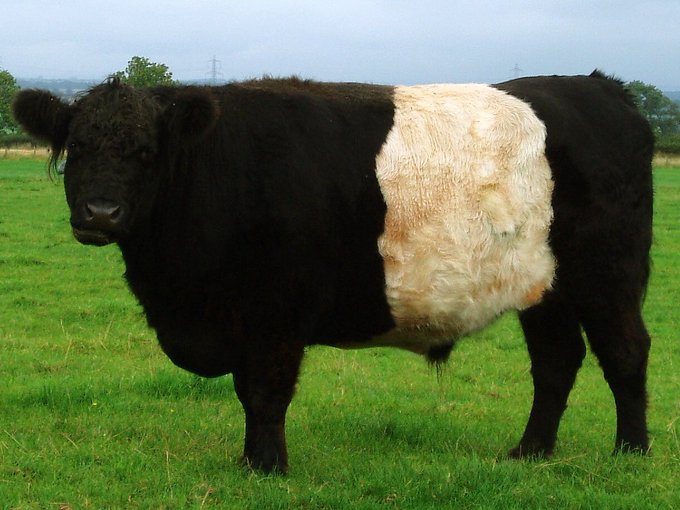
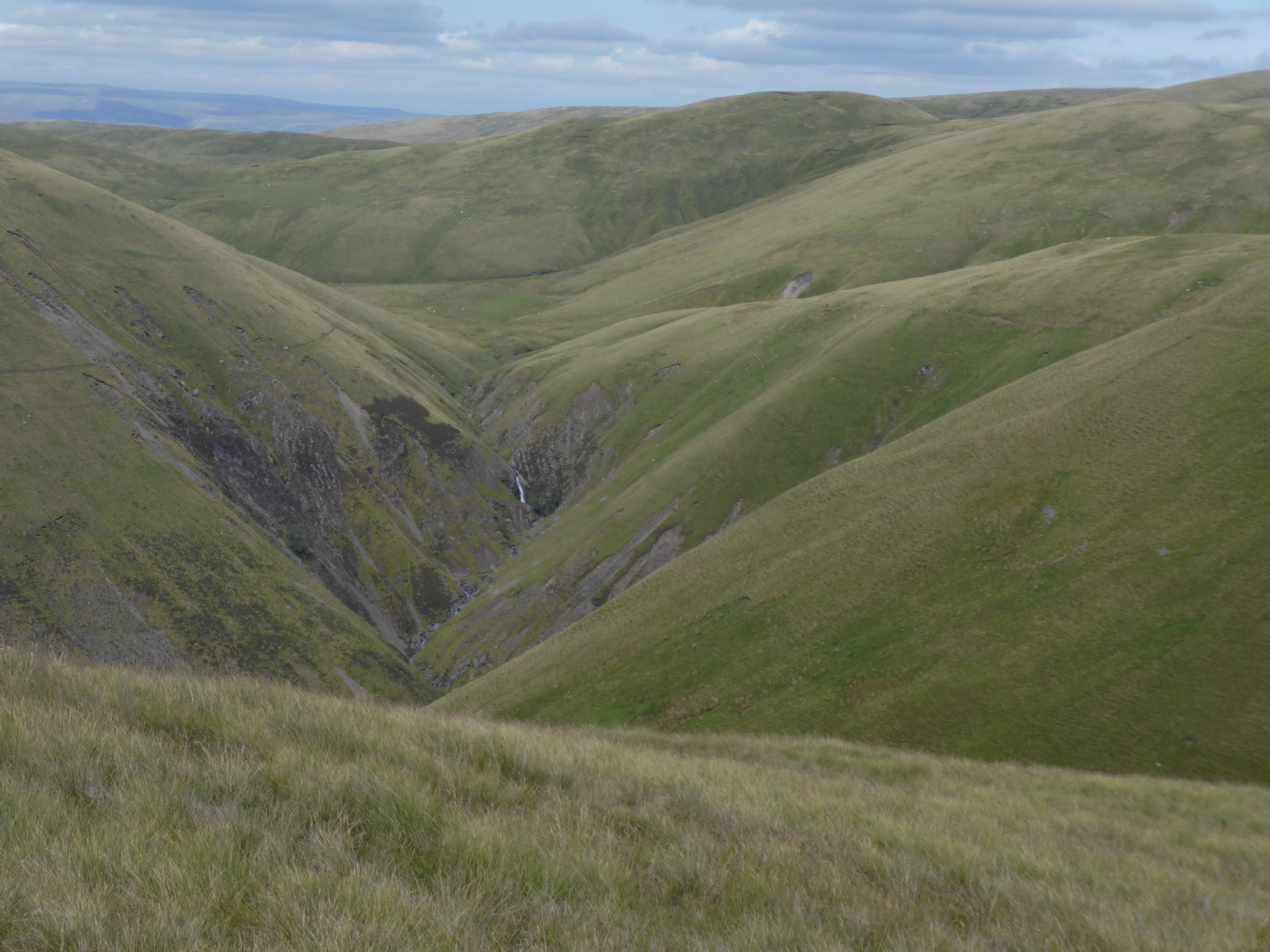
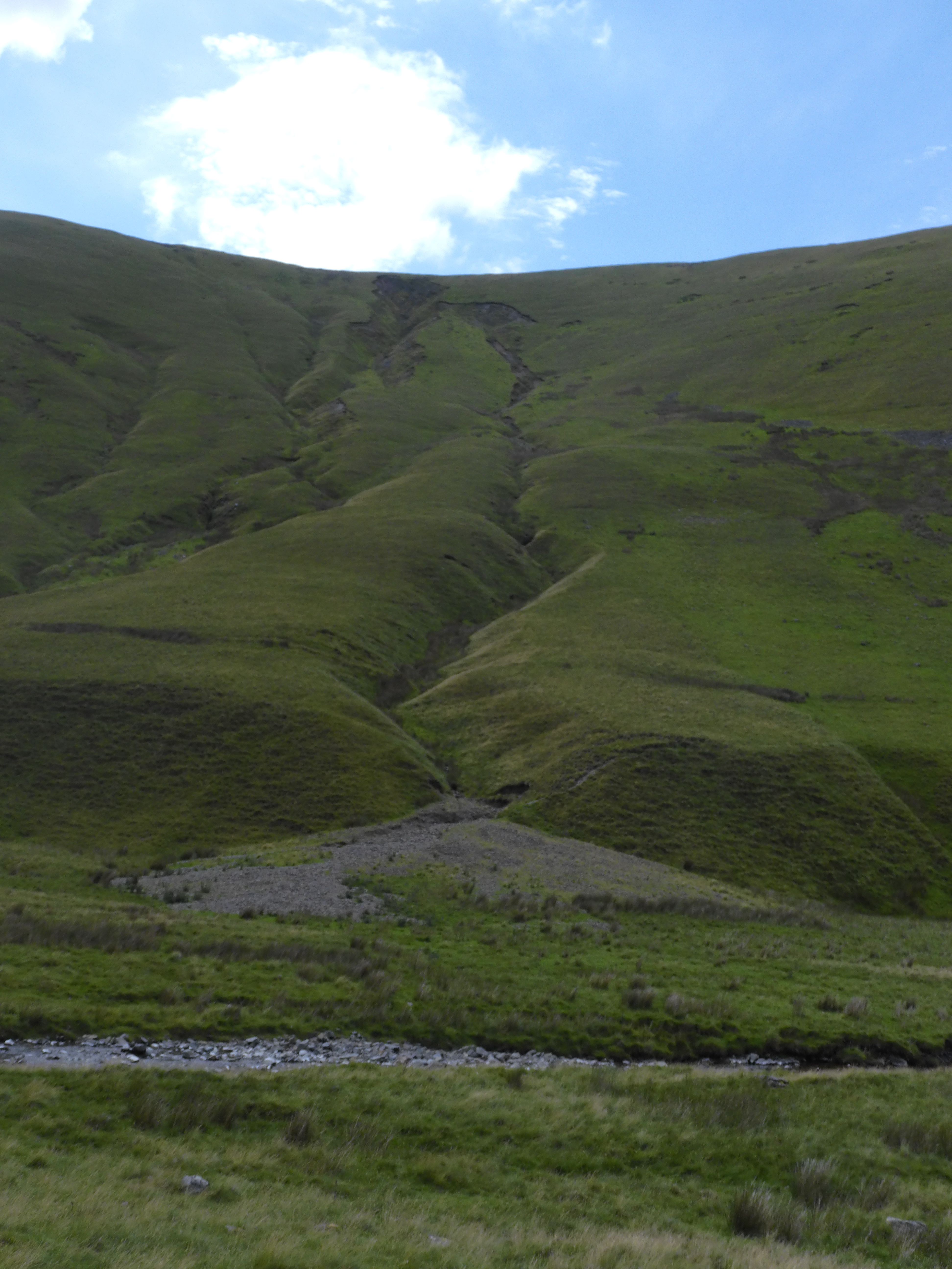
Chap 2, Holocene Landform Evolution deals with the sequence of events during the last 10,000 years. This began with the thawing of permafrost which resulted slope instability and the solifluction of reworked glacial till or head, which resulted in the fells being draped with reworked till. Much later were waves of hillslope gullying, which give the Howgills their characteristic aspect today. There was a major wave in the 10th century when Norsemen were rearing sheep. This slowed a century later due to William’s Harrying of the North, with a resurgence then a respite during the Black Death. This was a fascinating tying in of geomorphology to human history. Reflecting on this in the field should lead to good questions on the effect of us humans on the environment. Less historically, but more geomorphologically, he deals with gully structures and alluvial fans. A section on vegetation describes how, from pollen data, the fells were wooded or partially wooded before the Roman invasion. Gully formation was favoured by extreme wet conditions and human activity, especially sheep rearing. In the last few years Belted Galloway cattle have been introduced on the northern hills to remedy the damage done by sheep .
Chap 3 The modern Geomorphic System deals with the more recent erosional activities. Here Harvey uses his nearly half a century of field work in the Howgills to great effect. All the active gullys are identified and some given special attention, often giving a sequence of events, with photos, of the last 50 years. Carlingill and Grains Gill’s Gullys get pride of place. As well as that he describes the extreme events of July 1982 and December 2015, Both events reactivated gully erosion, affected the rivers and changed gully to channel coupling effects. The maps and photos make the events very clear.
Part Two is on the field sites. First is a reconnaissance road trip round the Howgills to bring out the salient features. It is the only trip which can be carried out by car, preferably by bike. The route of some 40 to 50 miles gives a fine overview and locates the stopping places.
Secondly, the main part are lengthy trips into the heart of the Howgills along various valleys. To the west are Grain’s Gill and Carlingill. To the north are Langdale, Bowderdale and Weasdale and to the south Cautley, the Gills above Sedbergh and Chapel Beck. I followed the routes on Carlingill, Bowderdale and Cautley. Harvey’s routes are detailed and easy to follow, but involve crossing rivers without bridges and the top of Carlingill by the Spout is serious. They are not for the faint-hearted but are magnificent routes in remote areas.
Carlingill
Carlingill is the highlight of all the excursions and is on tough terrain. I confess I went right up to the spout in Carlingill and had a challenge getting out of it!
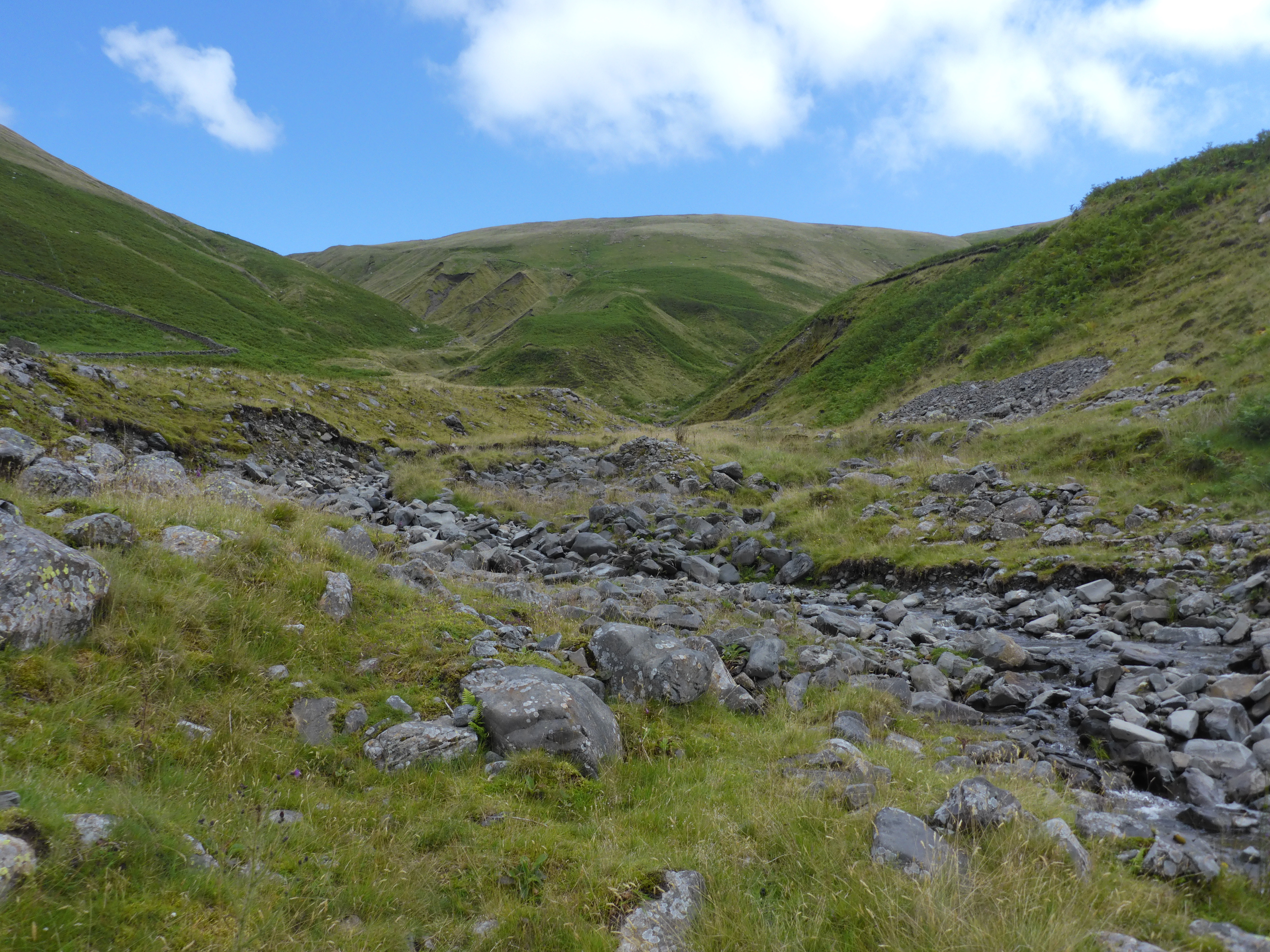 Grain’s Gills Gullys from the fan near the confluence with Carlingill
There is a little parking by Carlingill Bridge, where can find the track. On either side are the lovely bog plants Butterwort, bog asphodel (flowering in July) and Sundew. The track on the left side going up Carlingill is never very visible but the lower parts are fairly easy but may require crossing the gill which could be full. The complexities of erosion of Grains Gill is fascinating and some will divert for a close look. After that the gill rises slowly with various gullies and erosion of different ages on either side.
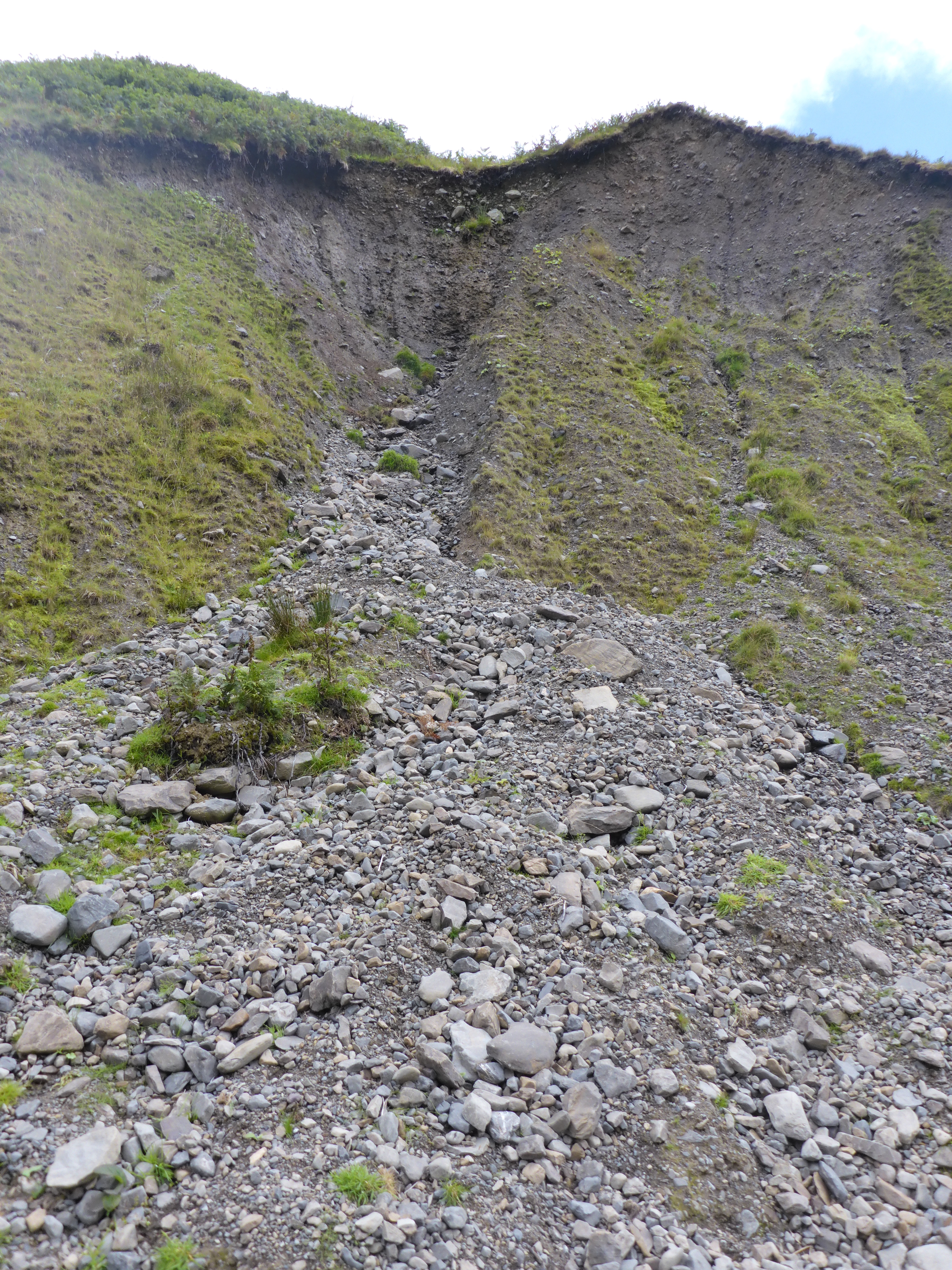
Once you go past Green Knott Gill the path either gets better or worse, depending who you are! The gill narrows and the path becomes more indistinct. There is also a steep drop in to the gill for the unwary.
At the confluence with Little Uigill Beck the gill narrows and neither alternative is easy.
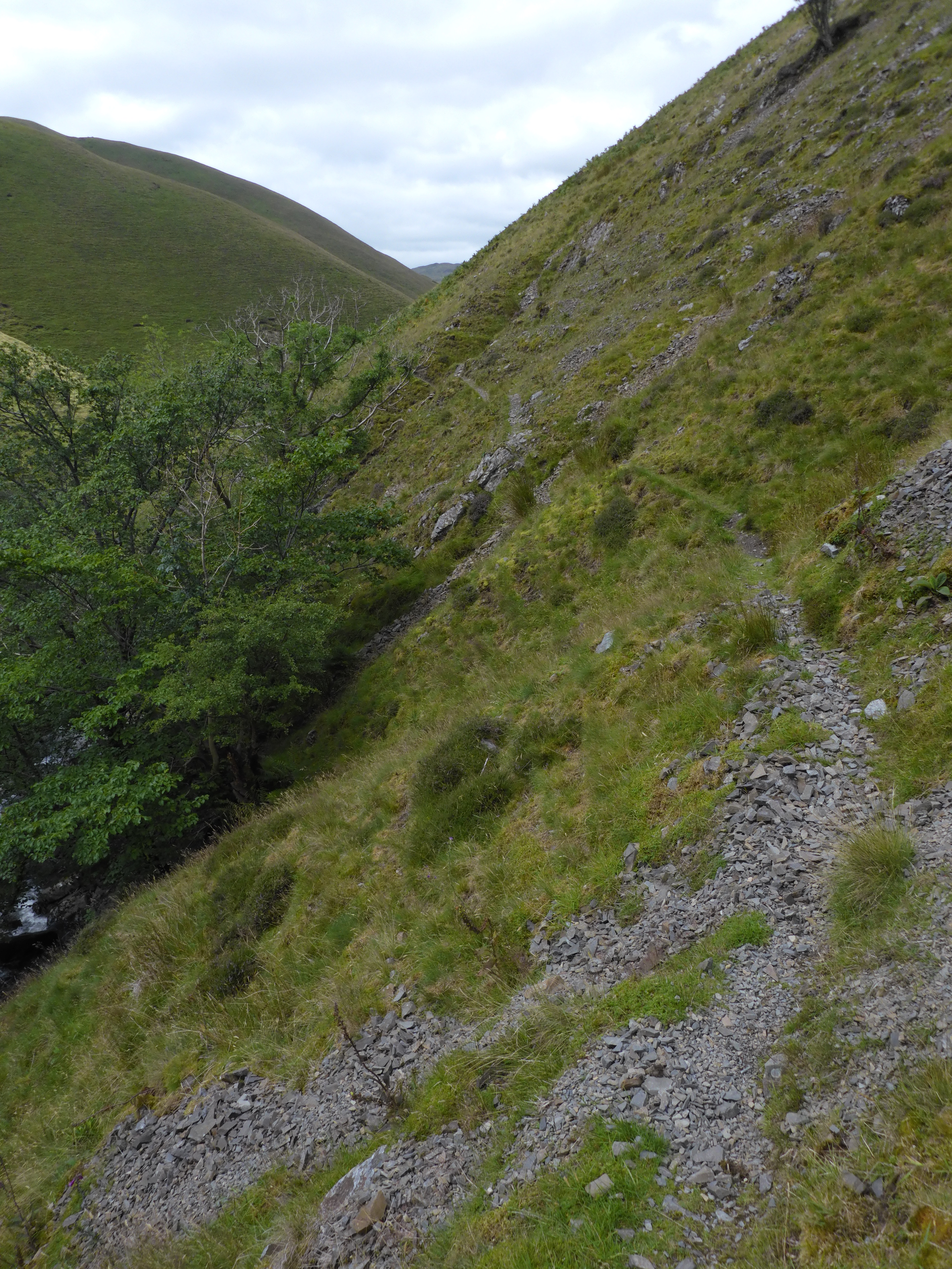
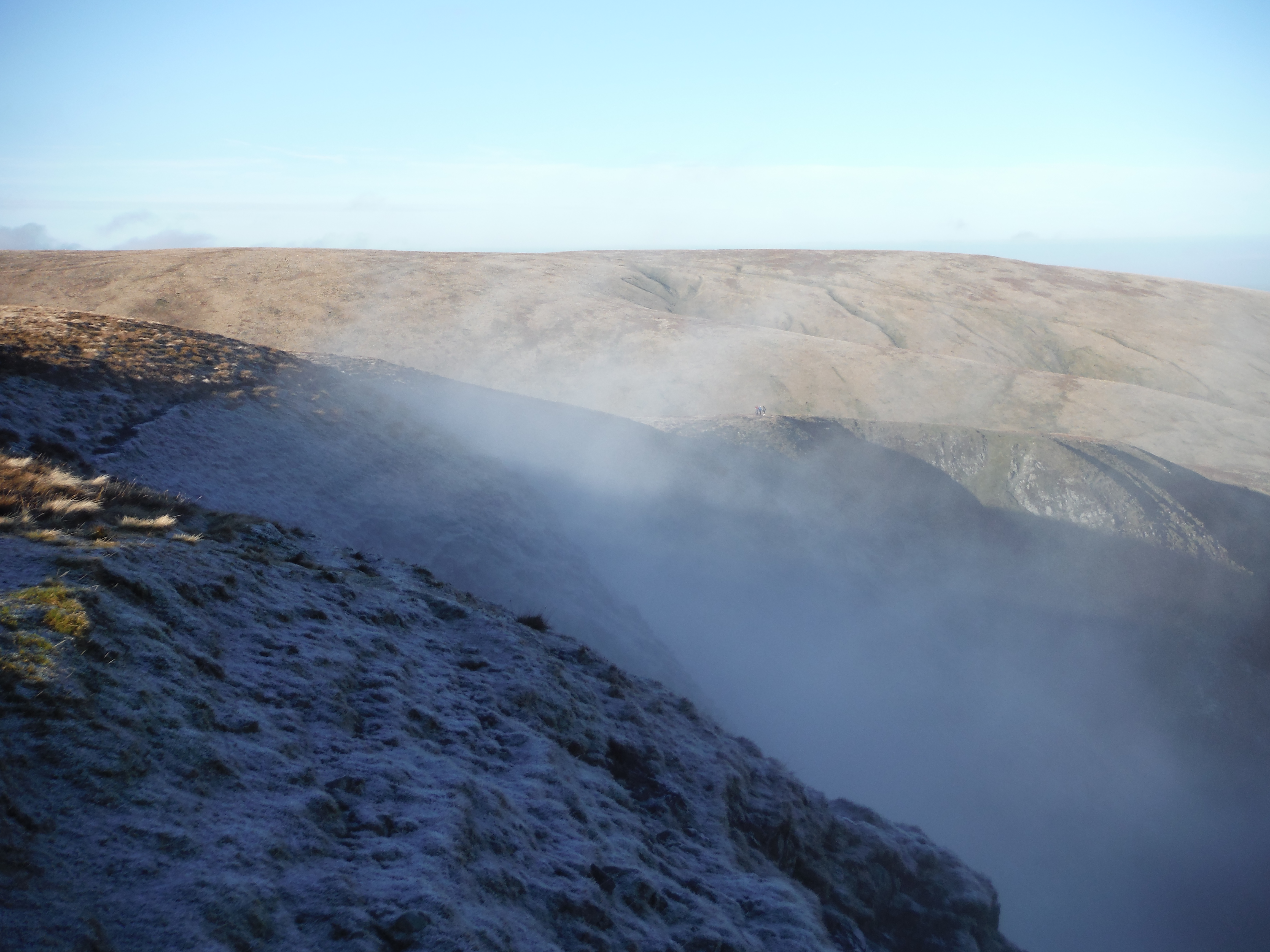
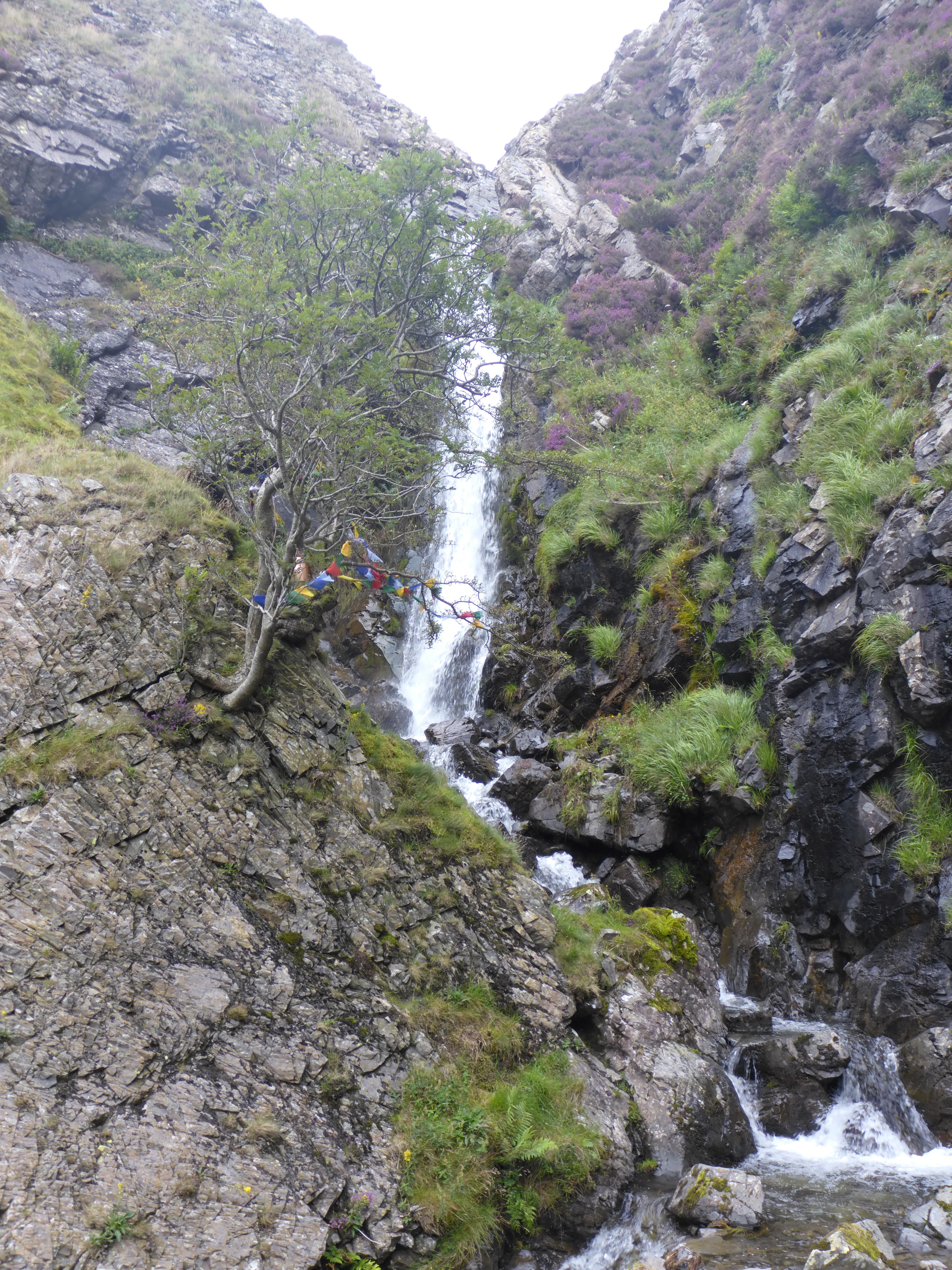
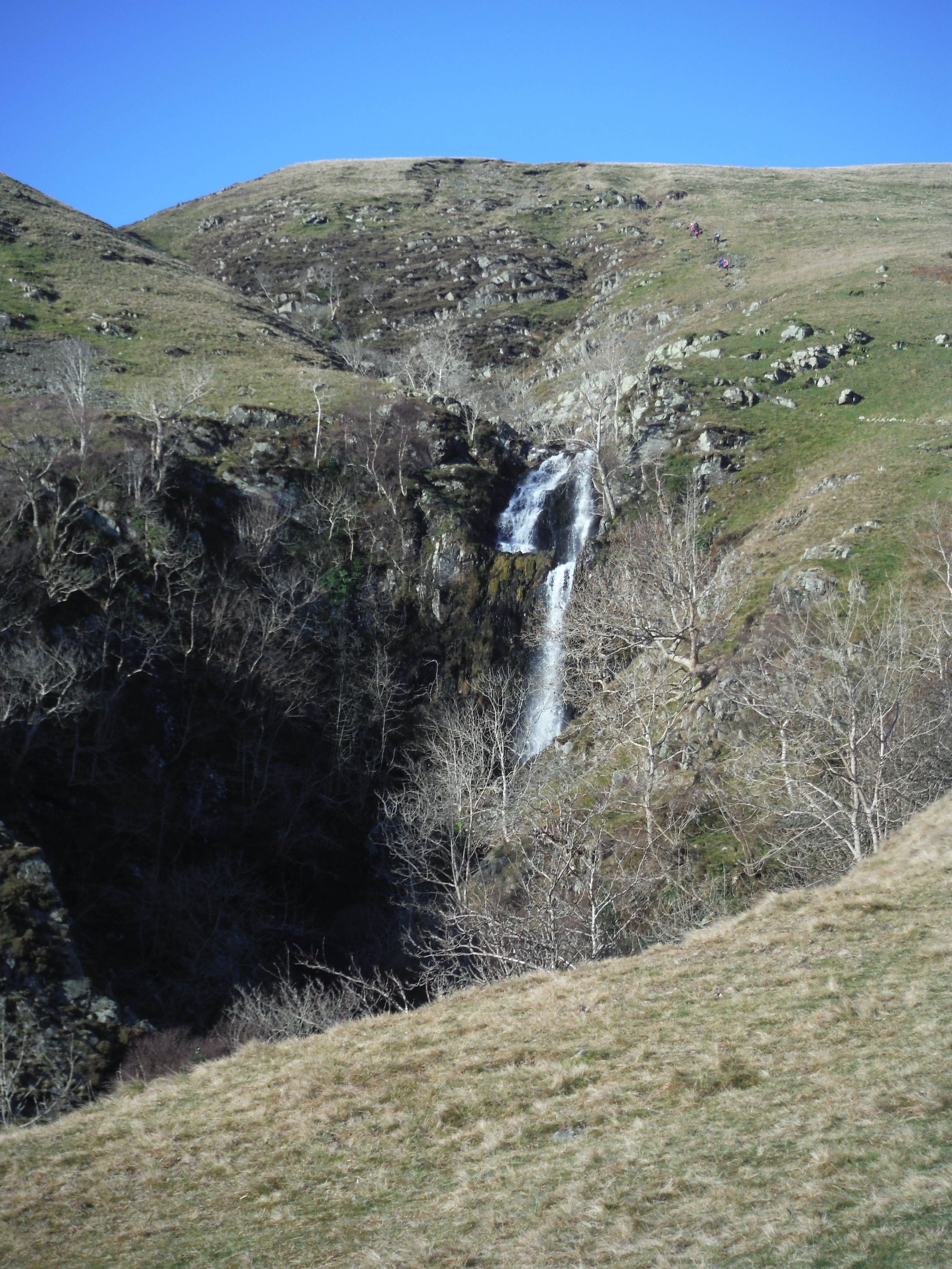
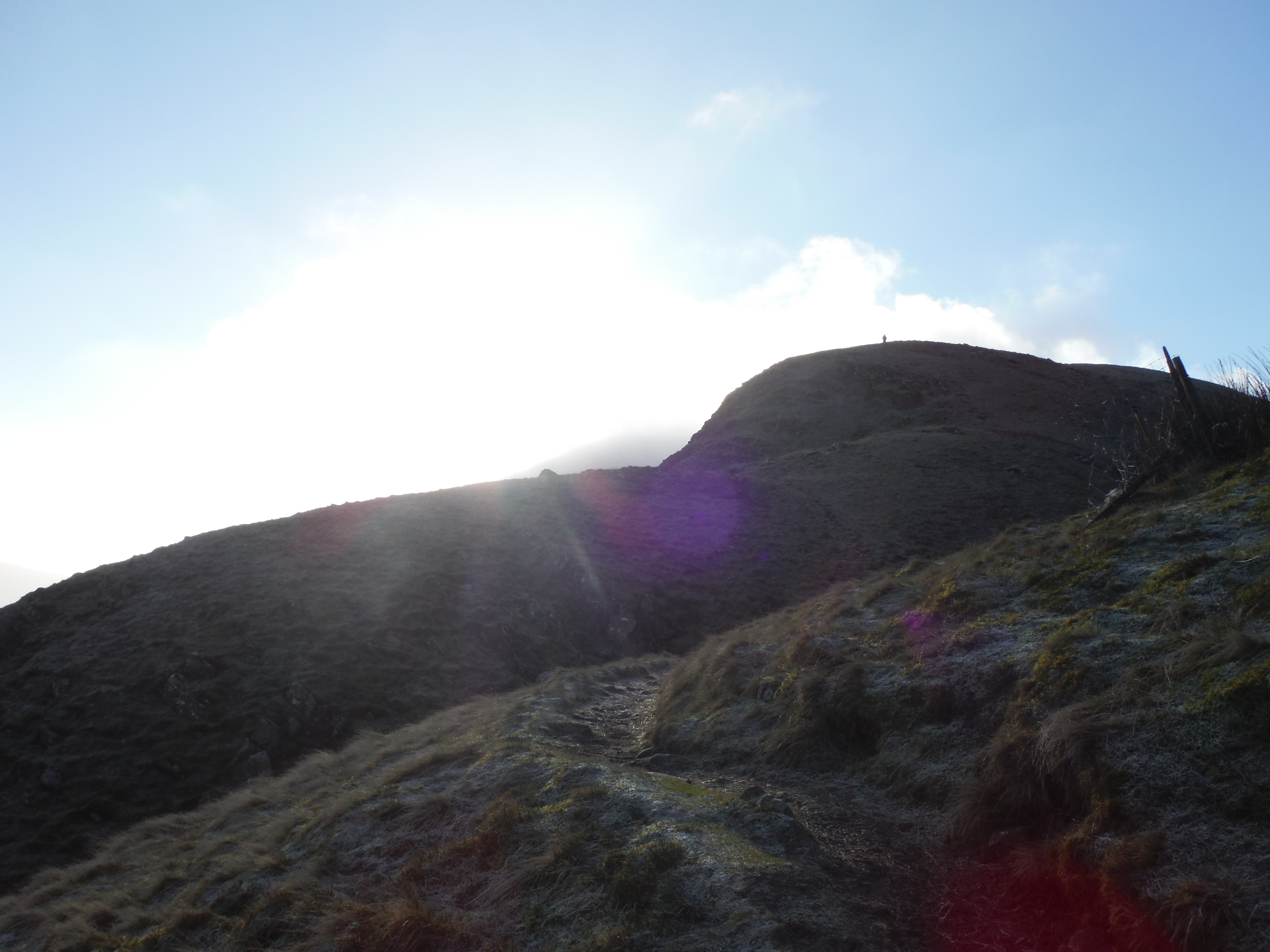
Continuing up Carlingill becomes more and more challenging and the spout is a dead end unless you are partial to hairy scrambling. I happen to be past it. the spout is dramatic, but was spoilt by some alternative religionist tying bits of plastic onto a tree. I presume they thought it very green to leave such rubbish, which no better than balloons which descend on the fells. I am sure some will say I’m religiously intolerant. Maybe, but I don’t like litter of any form.
Reaching the point below the “prayer” tree I was faced with a trilemma. The safest and most boring route was to retrace my steps. Or I could scramble up the side of the waterfall, which I would have done thirty years ago. Anyway I had lunch and then climbed up the very steep grass sloe to the right of the stream as you can see in the next photo. I am not sure of the wisdom of going up steep grass on all fours!!
Carlingill Spout and alluvial fan at Blakethwaite from Knowles. The gorge below the spout is difficult to escape from by climbing with a choice of rock or very steep grass!!
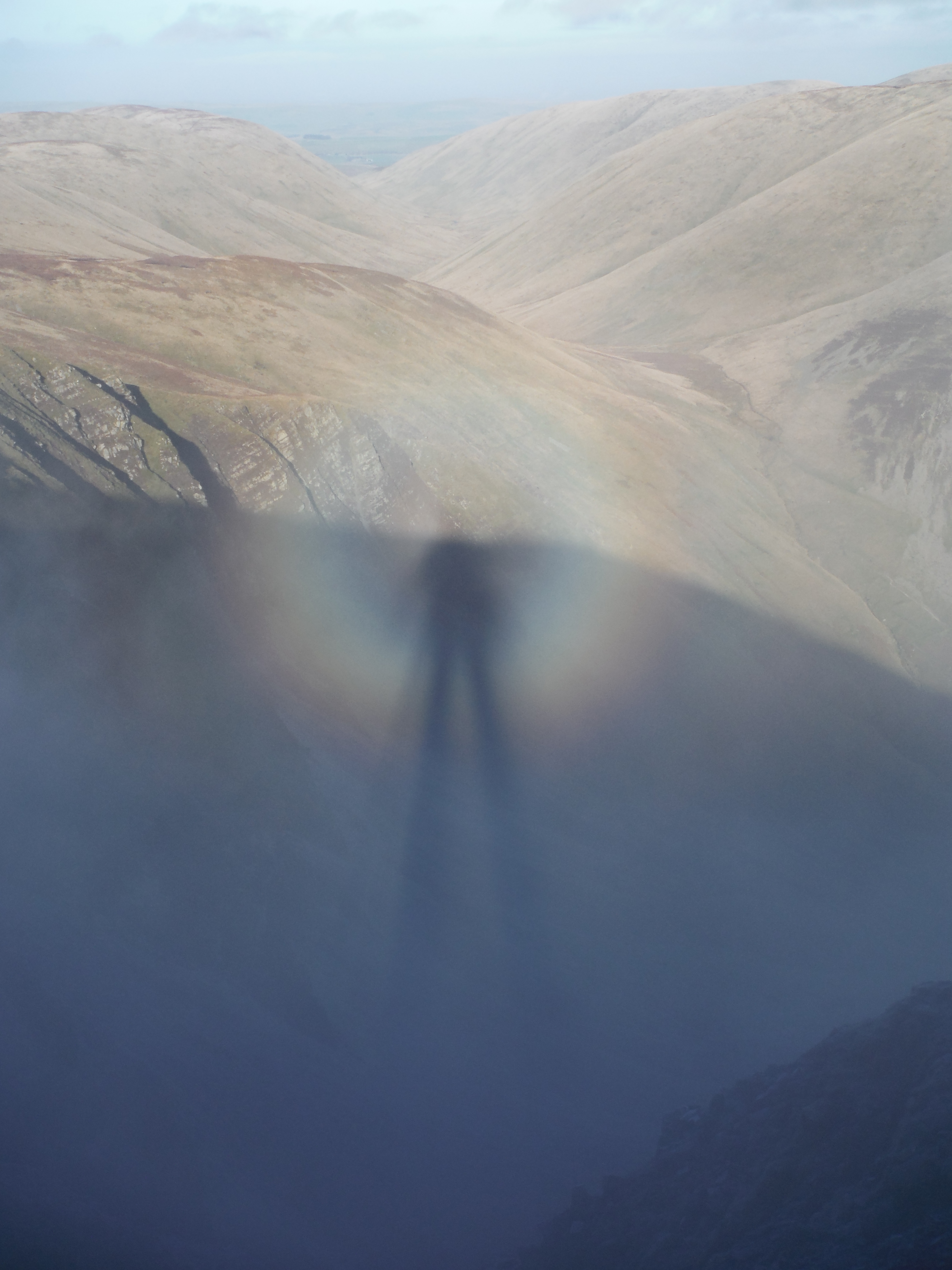
Once I got to the stop of the steep slope I gave a sigh of relief and then went more gently upwards (to the right in the photo) up Uigill Rigg to the top of Breaks Head 628m and then followed the track to the northwest along the ridge, looking down on Carlingill. It was an excellent walk full of geomorphological interest. It is not for the fainthearted.
Harvey’s description of the gullys, alluvial fans etc in each of these is very clear and informative.
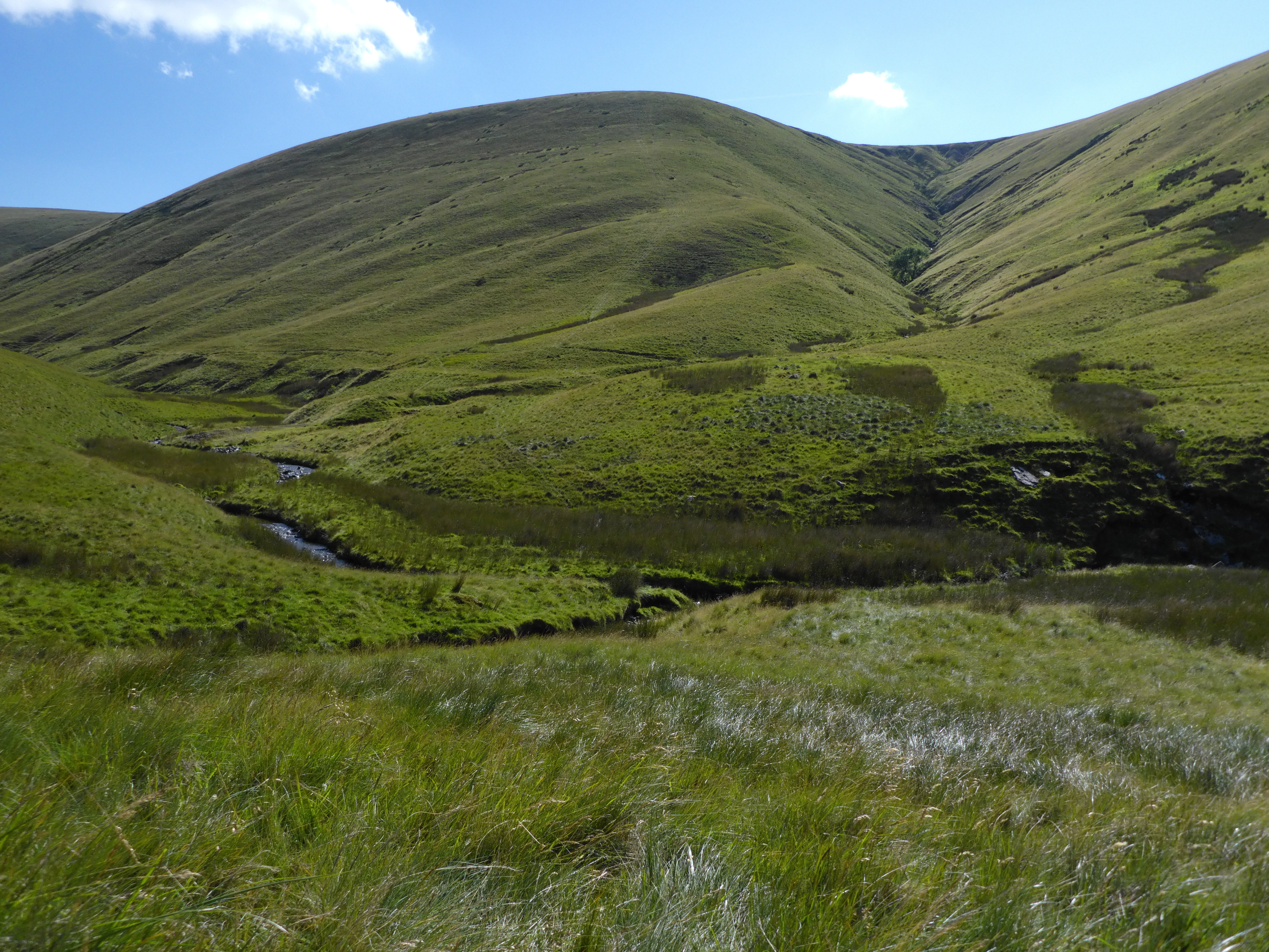
Bowderdale
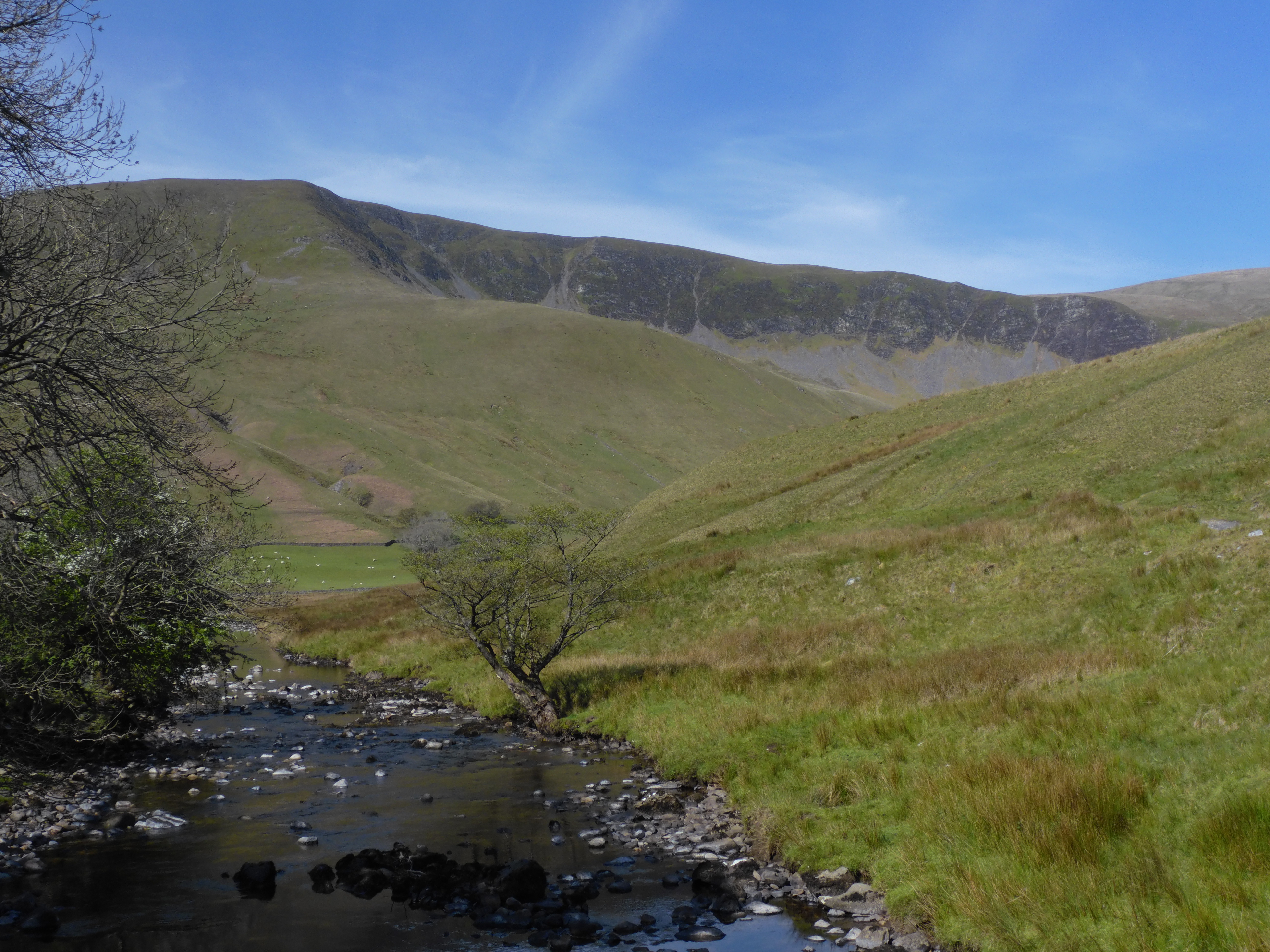
The route up Bowderdale is easier – if you can keep your feet dry – but the various gullys and fans are expounded in clarity and detail. I parked the car by Potts near Scar Sikes and followed the track over to Bowderdale. As i dropped down to Bowderdale the track got soggy and I was treated to sundew. I pointed them out to some walkers, who had never seen them before.
Going up the Dale was fairly easy and Harvey’s guide pointed out many features, including the floods of 1982, where he had the advantage of seeing the area before and after the flood. His comments brought much of the scenery alive to me in a way I’d missed so often in the past.
Greencomb Gully and the fan from the 1982 flood
Hazel Gill with the more vegetated fan for the 1982 flood.
When i reached Hazel Gill I’d intended to go up randygill Top but felt lazy and walked back down the valley fording the river, which was very low, and then back to the car.
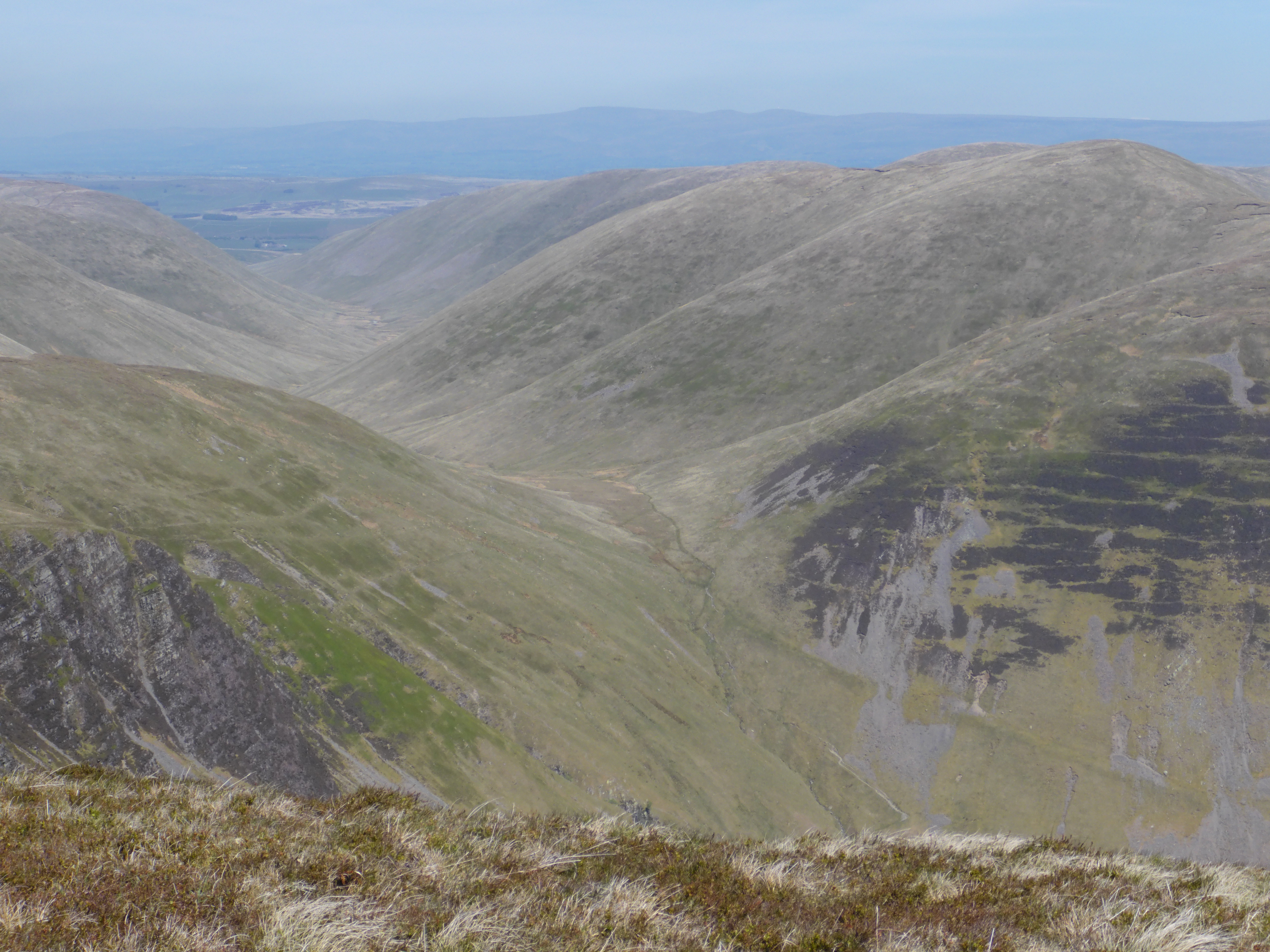
Cautley Spout
The route to Cautley Spout and beyond is one of my favourite hil lwalks, where I once saw a Brocken spectre.
Harvey gives safety warnings!! I suppose these are necessary from the number ill-equipped walkers on the hills. the walk from the Temperance Inn past the Spout and then one of the several routes to The Calf 676m or 2217ft is not the most difficult but can be fun for navigation in mist! The river capture at the col to Bowderdale is explained. It is an open question whether the cirque at Cautley Crags is due to the Loch Lomond advance or is earlier. Whether or not you stop at the foot of the Spout, you are treated to a range of geomorphology from glacial cirques to later solifluction. This is a gem of a place which can be tailored to the group’s ability and agility. By stopping near the foot of the Spout enables one to see most of the salient features of Howgill’s geomorphology in one visit. Much more can be seen if one continues to the top of Cautley Crags. I love the path which is steep and airy in places.
If geomorphology is your only interest there is no need to go further but walking on the edge of Cautley Crags to Great Dummacks is delightful, unless there is a strong wind.
Or take the more direct route up the Gill becks to the Calf, passing old sheepfolds and “houses” en route.
View from the bridge of the Rawthey of the Cautley glacial cwm, Cautley spout is to the right.
View from top of Cautley Crags looking down Bowderdale. The steep line of trees shows the route of the Cautley
You can return from the Calf following a good path to Bowderdale and then cutting off on a diminutive tack to Bowderdale Head. A steep descent and then meandering through glacial deposits leads you back to the Inn, where you can buy some well-deserved orange squash. shortly before the footbridge you should finds some Butterwort and Sundew by going off the path.
The best two excursions are to Carlingmill and Cautley, and Harvey succeeds in making the geomorphology come alive.
This excursion guide has distilled half a century of field work in the Howgills and has made it accessible for those, like me, with an indifferent grasp of Holocene geomorphology. The maps, photos and descriptions are very clear and make you ask with Thomas Huxley, “why didn’t I think of that?” This guide is a model of what a geo-excursion guide ought to be.
Often the Howgill fells are seen as dreary and can be likened to half a dozen dead whales lying side by side, with one having its mouth open at Cautley Spout. Above are three routes I did which are variations on Harvey’s detailed routes.
As well as expounding the geomorphology of today Harvey also considered what it was in the past. It was so different then and going back 1500 years or more it was far more wooded than it is now. trees have been in decline here for 2000 years, as in the Lakes and Dales and are due to two mammals. These are sheep and humans.
The serious deforestation began with the Vikings, who, when they were not pillaging, were tending sheep on the fells. By nibbling every green shoot down to ground, the sheep prevented the regrowth of any tree or shrub and got rid of most flowers. It’s same story in the Dales . Lakes and Wales, but fortunately Belties, or Belted Galloways, are replacing the sheep and doing excellent conservation work. It is not often you can eat conservation workers. And so until 1066 deforestation and erosion were going hand in hand, or rather, mouth by mouth.
One of the good things William the Conqueror did was to slow this process down for a while by sending his henchmen to the desolate north to harrow it – known as the “Harrowing of the North”.
But when the harrowing stopped shepherding resumed and so did the erosion until the bacterium yersinia pestis arrived and caused the Black Death, thus stooping the raising of sheep again. Soon things recovered and the sheep continued their destructive geomorphological work up to the present day.
The Howgills are not the best place for wildlife and flowers are not numerous, but are there if you know where to look.
More recently, as with the rest of the high ground in northern England restoration has begun and we shall, hopefully, see more trees and their attendant wildlife.
Meanwhile the Howgills are fantastic place to explore and relatively few people visit. If you go I hope essay and Harvey’s book bring it to life for you. If you want more then use the OS 1:25,000 OL19 and from that you’ll get a gist of my routes!
this is an expansion of a review I did for the Yorkshire Geological Society